Sand Point Lighthouse — Escanaba, Michigan

Our route home on Sunday took us within three blocks of this lighthouse. It was too early in the morning for tours, but we got out and wandered around for 10 minutes or so.

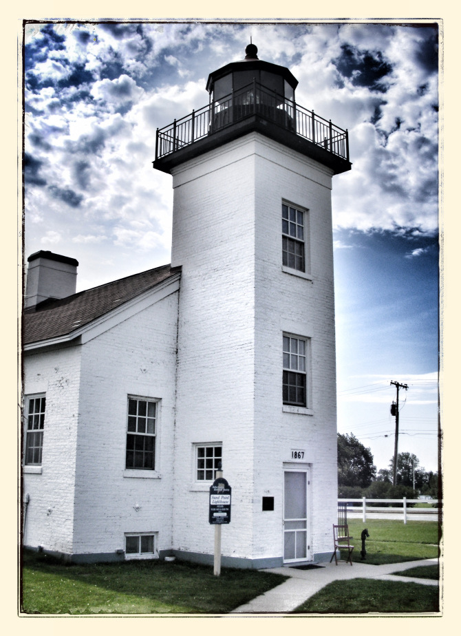
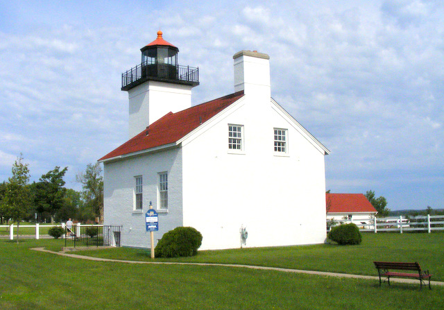
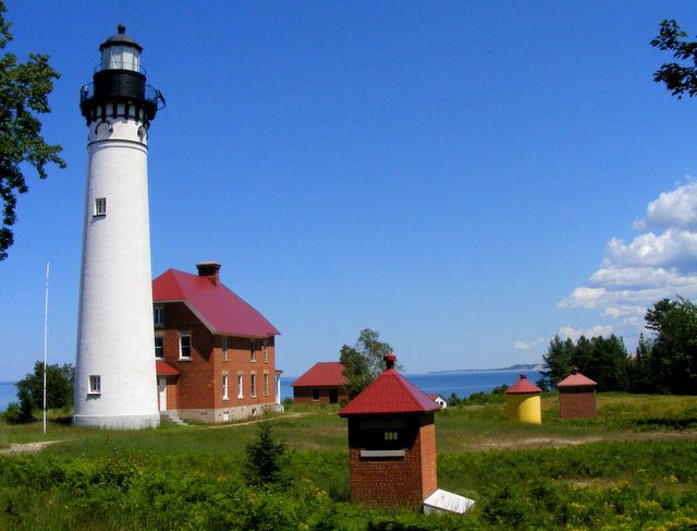
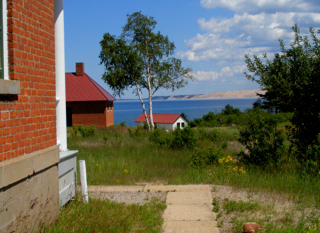
The lighthouse was built in 1868 and operated until 1939 when an offshore crib light went into service. The body of water in the background is Little Bay de Noc on Lake Michigan.

The lighthouse has a mysterious past. In 1868, a woman named Mary Terry was named keeper of the just-built lighthouse after her husband died of cancer. She was one of the first female lighthouse keepers in the United States. In March, 1886, a fire did a great deal of damage to the building and killed Mary. The plaque at the site reads:

“Many people thought that Mary Terry had been murdered, robbed, and the lighthouse set on fire. The south lighthouse door was open and the lock was found with the bolt shot forward as if the door had been forced open, not unlocked, and the fact that Mary was found in the oil room and not in her bedroom, led people to believe there was foul play. Deep snow made it impossible for fire fighters to reach the lighthouse before it was very badly damaged. Some people who knew Mary Terry found it hard to believe that this was an accident since she was so careful and efficient.”

snapseed-70

The boathouse next to the lighthouse was built on Squaw Point (on the far side of Little Bay de Noc) in 1897 and moved here in 1914 when the decision was made to no longer have a keeper at the Squaw Point Lighthouse. From then on, the keeper at Sand Point had to boat across the bay every evening and light the light at Squaw Point.

And that was it. As much as we wanted to, we couldn’t drag this vacation out any longer — except for lunch at Culver’s.

Posted in Michigan | Comments Off on Sand Point Lighthouse — Escanaba, Michigan

Sunset, Night Three

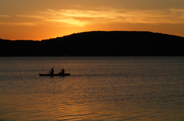
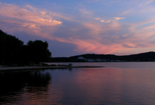
The sky to the south was putting on more of a show than the sky to the west this night.

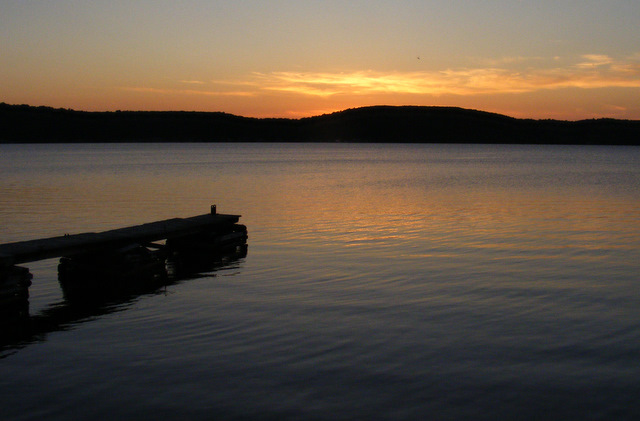
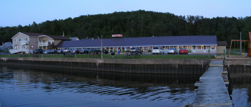
Here’s our motel from the end of the dock.

Posted in Scenery | Comments Off on Sunset, Night Three

Grand Marais, Michigan

On my drive back to Grand Marais from the Log Slide, I stopped to see Sable Falls and hike a short trail onto the Grand Sable Dunes. This proved to be a mistake. The falls were less spectacular than many others I’d seen over the past few days, and the hike was ankle deep through soft sand to a spot far less impressive than the Log Slide. The time I spent also got me back to Grand Marais too late to see any of the other museums in town.

The town surrounds West Bay, which gives the town its name. Grand Marais is French for Great Refuge. There is a set of range lights at the entrance to the harbor, with the (closed) keeper’s house museum in between. Here’s the rear range light.

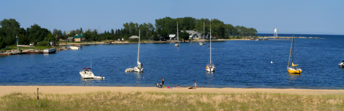
The sailboat in the above photo was flying up the channel that gave entrance to the harbor. I had to hurry to set up this next photo on the breakwater.

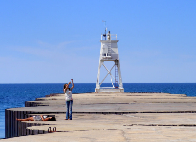
I walked out on the breakwater to see the front range light. The girl fiddling with her fishing pole was complaining to her friend that there were no fish in this lake, and she was never fishing in this town again.

On my way back to town, I came upon a yard that was filled with old fishing boats. It looked like a combination junkyard and maritime museum.

I drove along the harbor and explored the town. The rear range light is in the distance. On the left is another old fishing boat parked by the junkyard.

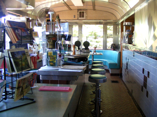
It was getting close to time for me to head back to Munising to take my wife and daughter out to supper. It had been an amazing afternoon, and I got to thinking that some ice cream would make it just about perfect. Seconds after I had that thought, I happened upon the most serendipitous moment of the vacation (with the possible exception of the fireworks). There, tucked back in a small residential area, was an authentic diner.

I went inside and ordered a chocolate milkshake.

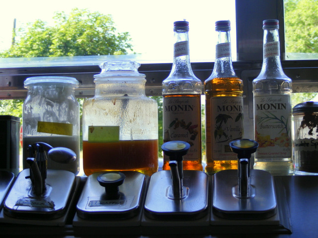
The girl behind the counter told me they were out of chocolate ice cream. She said she could make it with Mackinac Island Fudge and chocolate sauce. I said that sounded delightful.

A postcard I saw said, “This rare 26-seat 1949 Paramount ‘Road King’ diner car is the former Matamoras diner from the Pocono Mountains of eastern Pennsylvania. The diner came across the Mackinac Bridge to the shore of Lake Superior in 1997.”

The shake was awesome, and I didn’t even mind that the fudge chunks kept clogging up my straw. I headed back to Munising thinking that I definitely want to return to Grand Marais sometime.

Posted in Michigan | Comments Off on Grand Marais, Michigan

Au Sable Light Station

When I did my pre-vacation homework, I saw that the National Park Service gives tours of the Au Sable Light Station during July and August. But the same ranger who told me I couldn’t get to Au Sable Point from Hurricane River told me that this summer the tours were postponed until July 16 — six days after I would be there. Unfortunately, in this case she was right.

This was the scene as I emerged from the woods.

Au Sable is French for “with sand.” I think the inclusion of the preposition is “with goofiness.” The point is a hazard to boats because of an offshore sandstone reef and frequent dense fog. The lighthouse was built here in 1874 and is still in use.

The head lighthouse keeper’s quarters were built in 1909. The building attached to the tower housed the assistant keeper.

In my previous post, I mentioned that two rangers drove up in a truck. One was a grizzled veteran and the other was a rookie. The old guy was giving the young woman a tour because she was to be stationed here — six days after my visit. When they headed toward the tower, I hung around, hoping the guy would say, “Hey, as long as you’re here, would you like a look inside?” I’ve had things like that happen to me on more than one occasion, but not this time.

The lighthouse is on the left in this photo, with the Grand Sable Dunes visible in the distance beyond the outbuildings.

It was hot, but as you can see, it was a stunningly beautiful day. I climbed down to the beach and wandered about for a bit. The sandstone that presents such a hazard is mottled red and white in beautiful stripes and swirls.

The light is 86 feet above the lake. The foundation extends 23 feet below the surface and the walls at the base are four feet thick. Even so, keepers over the years have reported that the tower shook considerably during storms.

I would very much like to go back some time and spend an entire day on the beach along the point. It is one of the most stunning stretches of shore I’ve seen on a lake surrounded by stunning shores.

Posted in Michigan | Comments Off on Au Sable Light Station

Into the Wilderness …

So it was like this. Before we left home on this vacation, I did some homework and saw that there was a lighthouse — Au Sable Light Station — within Pictured Rocks National Lakeshore. There is no road to the light, but there is a road to the Hurricane River Campgrounds, and from there the light is an easy one-mile hike away. Hurricane River Campgrounds is a pleasant 30 miles drive eastward from our motel on a pleasantly paved road. It sounded like a pleasant afternoon’s outing.

But when we arrived in Munising and picked up a map of the park, I saw that the road to Hurricane River was closed for repairs. I asked at park headquarters and was told that there was no way to get to the light from the west. To get to Au Sable Light was now a much trickier endeavor. It involved a 24-mile drive to where the road was closed, then a 12-mile eastward drive along a dirt road, then a 6-mile drive north to the town of Grand Marais and another 9-mile drive back west to the Log Slide Overlook. From there, it was a 2-mile hike through the woods down, and back up,  a 400-foot hill.

So, instead of a pleasant afternoon’s outing, it had turned into a three-hour round-trip drive and a somewhat difficult hike. I still wanted to go. My wife and daughter thought an afternoon relaxing by the motel sounded more appealing. So I abandoned them in Munising (with the fudge we’d just purchased) and took off.

The drive sounded more intimidating than it turned out to be. The dirt road was in good shape, and I made it to Grand Marais in an hour. After touring the Pickle Barrel Museum, I headed back east to the Log Slide Overlook.

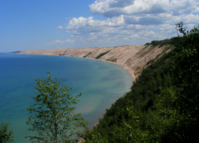
The main feature of the eastern end of the park is Grand Sable Dunes, about eight miles of HUGE dunes along the shore of Lake Superior.
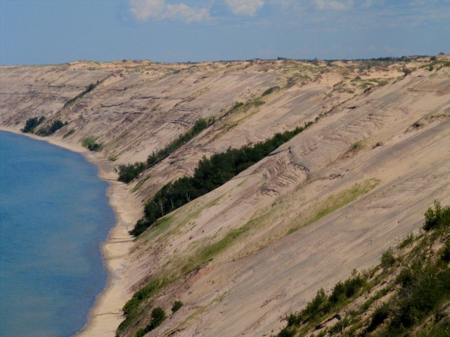
Lumberjacks used to slide logs down the dunes into the lake somewhere in this area. There’s a crease in the dunes called the Log Slide where people can walk down to the shore. I didn’t go. There’s a sign at the top that says (not in these exact words, but in words to this effect), “You’re an idiot if you climb down to the lake. If the climb back up doesn’t kill you, sand slides probably will. The hike down will take 15 minutes. If all goes as well as it possibly can, the hike back up will take two hours.”

To give you some idea of the scale, take a look at these two people standing in the lake.
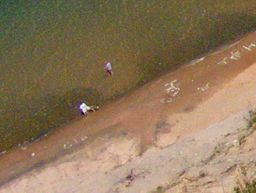
Now notice those same two people at the lower left of this photo.
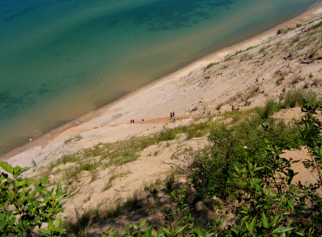
I left the path and walked to the edge of the dunes to take the above photo. Then I looked down and discovered that I was putting my resistance to poison ivy to the test. I was ankle deep in the stuff with no way out except to wade through some more. I’m happy to report that I’m still immune.

Off in the distance, I could see the Au Sable Light, my destination.
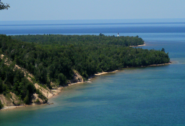
I left the overlook and headed west along the trail. I was on a section of the Lakeshore Trail that runs the entire 40-mile length of the park and is itself part of the North Country Trail that will eventually run from upstate New York to central North Dakota. It wasn’t an impressive trail.
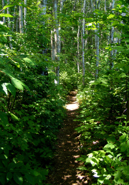
Most of the time, I could see the lake off to my right.
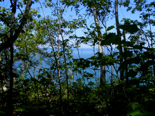
Occasionally, the trail ran along the edge of the dunes and I could see how far I’d come.
Remember how high above the lake I was at the Log Slide Overlook? And did you notice that the Au Sable Light was at lake level? That meant that, at some point, the path I was on was going to go down. Fortunately, it wasn’t quite as steep as the Log Slide, and it was made of firm dirt and not loose sand.

I was alone on the path. I was very aware that I was hiking into a wilderness and, since I was told there was no other way to get to where I was going, I thought I just might be the only person there. If that was the case, I would be two miles from the closest human and probably much closer to several Black Bears, Timber Wolves and Moose.

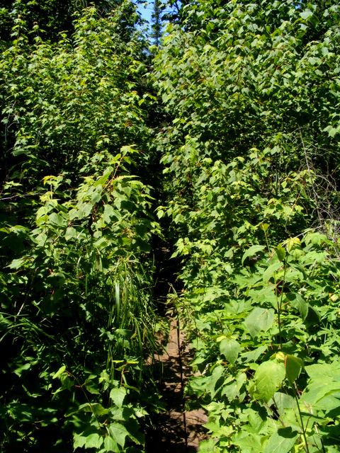
At times, the trail almost disappeared.
The path continued along the shore after it came down the hill. This shot is looking west.
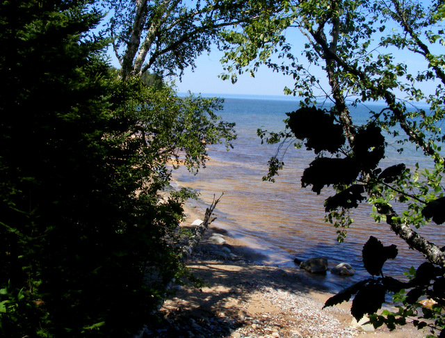
And here’s one looking back east toward the dunes.
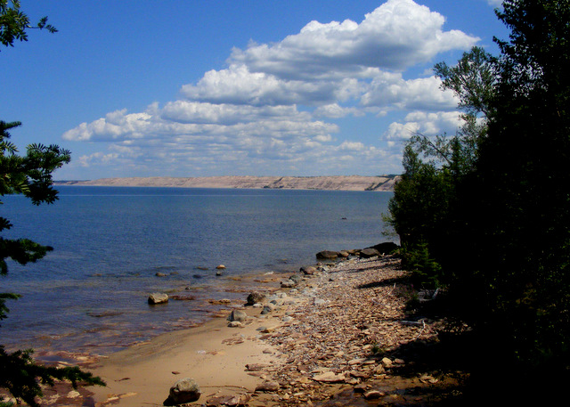
I did not see another person during the entire hike to the point. When I got to the clearing by the lighthouse, however, there were several people around — including two rangers who drove up in a truck. I heard them talking with a group of four women who said they had hiked in from Hurricane River and hoped they’d parked in the right place. (The ranger said they had.) There was also a couple in their 70’s and a young couple with an infant — all of whom had come from Hurricane River. All together, there were 22 people by the lighthouse. I passed an additional seven on my hike back. My adventure was neither heroic or necessary.

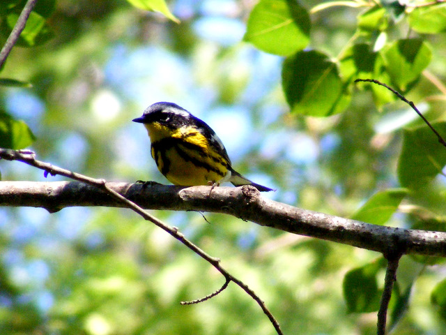
On my hike back to my car, I spotted this Magnolia Warbler singing along the trail.
Posted in Michigan | Comments Off on Into the Wilderness …