Wisconsin Concrete Park

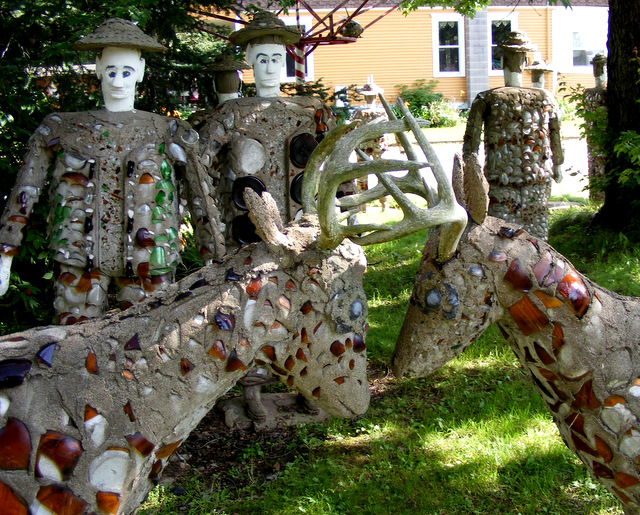
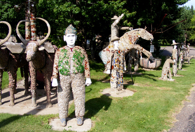
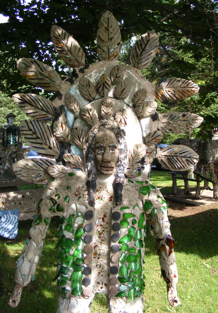
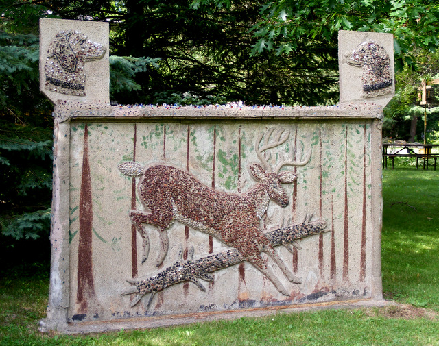
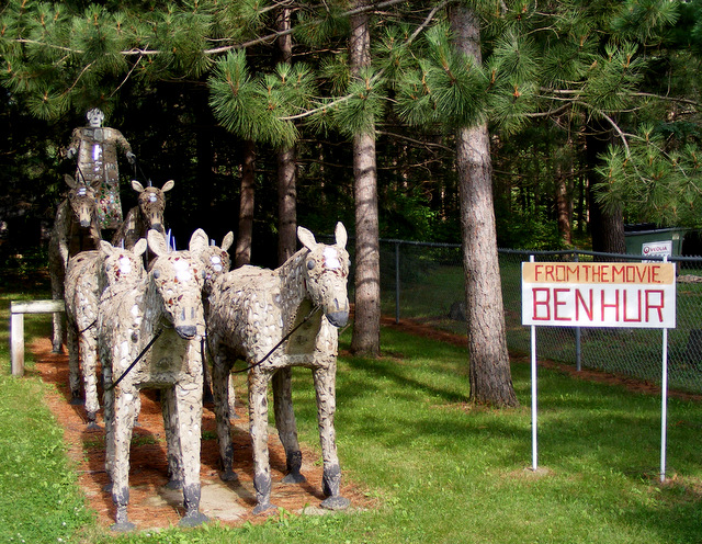
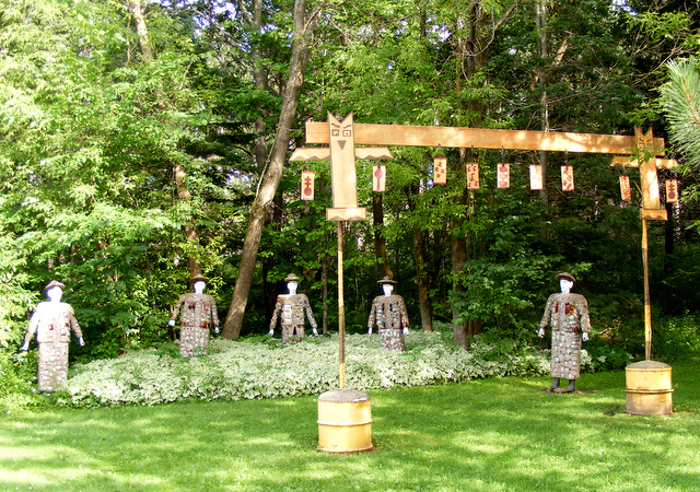
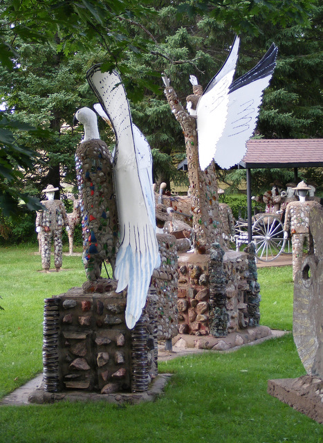
Fred Smith was born in 1886 and died in 1976. In between, he was a lumberjack, owner of the Rock Garden Tavern and creator of the Wisconsin Concrete Park. He began sculpting with concrete and glass when he was 63 and worked on the park for the next 15 years until he had a stroke. Fred never learned how to read or write. His descriptions of his pieces were narrated to a typist. Here’s Fred
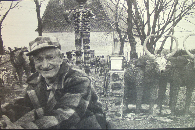
We made a 10-mile side trip to Phillips, Wisconsin to see the park and spent about half an hour wandering about. I’m not certain how I feel about Fred’s labor of love. It’s not good. I’m not even sure it’s art. But it is compelling.

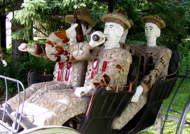
Here’s Fred’s first work. It’s known simply as “Barbecue.” Fred built it to celebrate the World Series of 1948 in which the Cleveland Indians defeated the Boston Braves.

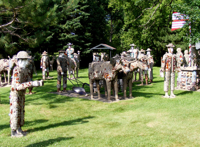
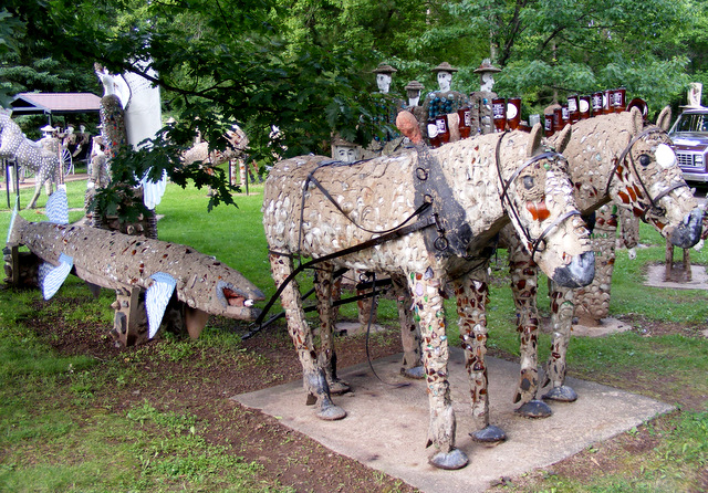
Here’s his last work, called “Budweiser Clydesdale Team.” It took Fred six months to create it, and shortly after he finished he had a stroke. He spent the last 12 years of his life in a nursing home. You can click on the photo to get a better look at the high-heeled shoes on the horses.

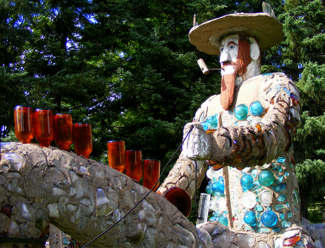
Somebody bet Fred that he couldn’t create a statue of “Paul Bunyan standing on a marble.” But he didn’t specify how large the marble could be, so Fred built this piece and won the bet. He called the marble a globe — or rather “glob.”

Fred’s description of this piece and two others nearby reads like this:

THE GLOBE OF PAUL BUNYAN

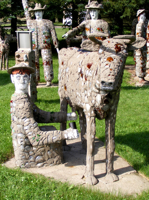
Paul Bunyan shows here the first power that came in for logging and farming is called oxen. Mr. Knox shows here how oxen are worked and tells how oxen are hooked up. Only a heavy chain hooked from the go-devil onto the link in the yoke. It shows how to lead them when they are at work. It shows here also a gang of his sawyers, Barry Swanson and Gust Johnson, the two big lumberjacks with an eight foot saw. It shows some of his logging tools and the two large wolf hounds he hunted with and also one of his bear traps. Paul Bunyan, the greatest logger in the state of Wisconsin and his three oldest lumberjacks. And I thank you.

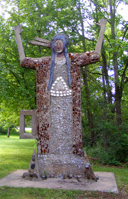
This one is called Man and Woman on a Rock.

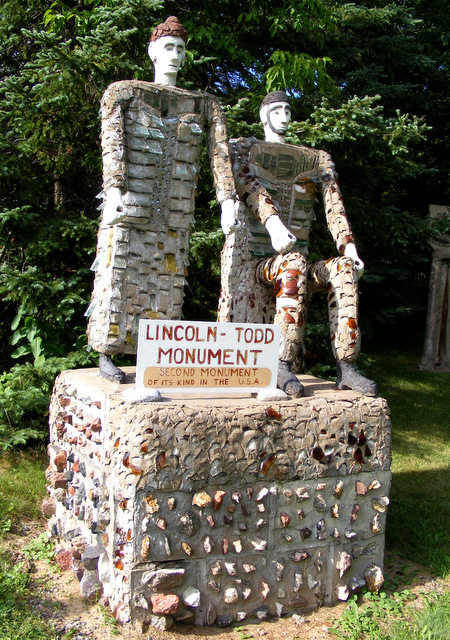
I think this one was my favorite. It’s called the Lincoln-Todd Monument. Underneath the title, it says, “second monument of its kind in the U.S.A.”
If you haven’t had enough of Fred, you can hold your cursor over the photos to get details.
Posted in Wisconsin | 1 Comment

Almost Halfway

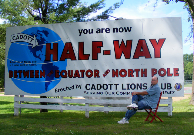
We pulled into Riverview Park on the Yellow River in Cadott, Wisconsin to get a shot of the billboard announcing that we were halfway between the equator and the North Pole.

Then I noticed the fine print on the globe — “Actual site of Midway point is 3 miles north of Cadott.”  I reset the mileage on our car so we could notice when we’d gone three miles and were actually on the 45th parallel, but we got to talking and totally missed it.

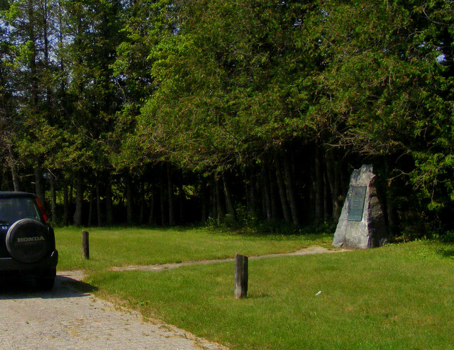
Not to worry. On our way home five days later, on Route 41 south of Marinette, Wisconsin, we found a monument marking the exact location of the 45th parallel.

But wait — what’s that it says?

Because the earth is egg-shapped and not round, the actual halfway point was eight miles behind us. Oh, well. At least we tried.
Posted in Wisconsin | Comments Off on Almost Halfway

Lifer #551 — Whooping Crane

grus (crane) americana (American)

Tuesday, July 6, 2010 — 11:40 am

Necedah National Wildlife Refuge, Wisconsin

Whooping Cranes are huge and beautiful birds that I would very much like to add to my life list. (Read to the bottom to find out why I now have.) The problem is that there are very few of them in the world and they never come anywhere near where I usually go. The only wild flock migrates between Wood Buffalo National Park in Canada and Aransas National Wildlife Refuge in Texas.

I was at a conference in Texas two years ago with my sister. We stayed a few extra days and drove to Aransas to look for the Whooping Cranes, but managed to pick the day before the first one arrived that fall. I don’t know when, or if, I’ll ever get back, so I decided to look for the next best thing — the sorta-wild Whooping Cranes at Necedah.

In 1941, there were 15 Whooping Cranes left in the world.  Thanks to conservation efforts, that flock now numbers around 200 birds. But what if some disaster — like an oil spill in the Gulf of Mexico — destroyed their habitat?

To prevent this, members of several conservation organizations have been breeding Whooping Cranes in captivity and attempting to reintroduce them to areas where they formerly lived. The main location of this effort is Necedah National Wildlife Refuge in central Wisconsin. Since 2001, cranes have been raised in Wisconsin in the summer and taught to migrate to Florida. The effort has been a great success. About 100 birds are now migrating back and forth and several pairs have bred. There remains one problem — almost all the nests have been abandoned, probably because of  the huge swarms of black flies in the marsh. Two chicks were hatched in June of this year and the oldest cranes are just entering their prime breeding years, so there’s hope.

Three or four years ago, we had an early-December snow storm in northern Illinois. I was shoveling my driveway when I heard a huge flock of late-migrating Sandhill Cranes fly over. I stopped shoveling and watched them for a few minutes. I was about to go back to work when I saw two more birds much higher in the sky. They were unmistakably large and white. They were moving incredibly fast on the strong north winds, and I had no time to run inside and grab my binoculars. I’m almost certain they were Whooping Cranes from the Necedah flock — right over MY house — but I can’t be sure.

Even if they were, I can’t count the Necedah birds for my bird list. There are rules for birding, and although I’m not a member of any club, I still follow them to keep things legitimate. The rules state that all lifers must be wild, free-flying and members of self-sustaining populations. The Wisconsin Whooping Cranes are wild and free-flying, but they aren’t even close to being self-sustaining at this point. But they are still huge and beautiful. I decided to stop on the way north and look for them.

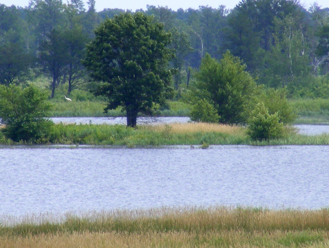
Naturally, you aren’t allowed to wander at will around the refuge disturbing the birds. There’s a tower overlooking Rynearson Pool at the south end of the refuge, and that’s where we went. It was a hot, muggy, but surprisingly bug-free morning. We walked the 100 yards from the parking lot to the tower where we were greeted by this view.

I had my binoculars and did a slow, careful scan of the area, looking for large birds. I saw a couple swans, a Great Blue Heron and several Canada Geese, but no cranes. I scanned again. And again. I was just about resigned to failure when I noticed something white on the shore behind that small island with three trees that can just be made out at right center in the above photo. Moments later a Whooping Crane walked into view. It was a long way away, but there was no mistaking it.

A second bird appeared to the right of the one in the photo. A few minutes later, they wandered back behind the trees. I scanned the entire marsh again and found two more. One was only in view for a second as it waded through tall grass. The other was feeding. Occasionally it would look up and show itself, but most of the time it was bent over and looked like this.

You see it, don’t you? It’s that tiny white spot to the right of the tree. And that was it. I would have enjoyed a better view, but where Whooping Cranes are concerned, I’ve learned to take my success in small doses. They were far away and they were uncountable but, for Pete’s sake, they were Whooping Cranes. If any one of about 1,000 things had happened at the wrong time in the past 70 years, they wouldn’t even exist. I’m thankful for the chance I had.

UPDATE: On November 15, 2019, I discovered that the rules for reintroduced species now state that a bird from a given population is countable as long as a wild-hatched chick has been recorded from that population prior to the sighting. The first wild-hatched chick in the Wisconsin population was recorded in 2006, making these cranes I saw in 2010 countable!

Posted in Wildlife | Comments Off on Lifer #551 — Whooping Crane

St. Charles, Missouri

photo-81-1024x768

We’d hoped to have a couple hours to wander about the historic downtown of St. Charles. But by the time we got there, it was 11:00, and we were supposed to meet my brother-in-law, nephew and daughter at the St. Louis Bread Company in St. Peters at 11:30. That gave us about 20 minutes. We drove through the downtown area and parked along the river. The temperature and humidity were massively oppressive, so my wife stayed in the car and read while I got out for a quick tour of Frontier Park on the Missouri River.

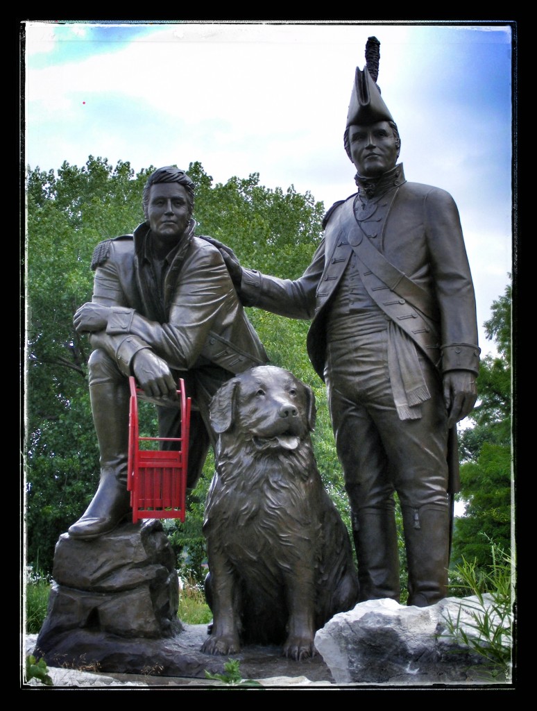
The main feature of the park is a monument to Lewis and Clark that features the two men and Clark’s dog, Seaman.

photo-82-774x1024

Giant red hibiscus were planted all around the monument.

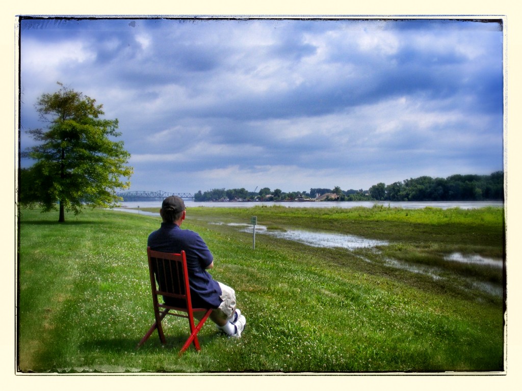
A guy about my age sat on a bench near the monument and watched me take these photos. I noticed him and thought he was probably homeless. He approached me after I removed the chair from the monument and said, “Obviously, you’re a concept photographer. Can I ask you about the significance of the chair.” When I told him, he thanked me and went back to his bench. I’m pretty sure he was disappointed. I think he figured it symbolized something meaningful.

We arrived at our meeting place about five minutes after the others got there. We ate lunch, then headed for home.

Posted in Missouri | Comments Off on St. Charles, Missouri

Gang aft agley

My plan for Sunday morning was brilliant. We’d leave the the hotel in Collinsville at 7:00 and drive north along the Mississippi River on the Illinois side for about 20 miles. When we got to the town of Grafton, we’d take the free Brussels Ferry across the Illinois River to Calhoun County, a remote rural peninsula that for most of its length can only be accessed by boat.

After a leisurely drive through the county, we’d take the inexpensive Golden Eagle Ferry across the Mississippi River to Missouri. We’d be about five miles from St. Charles where we were scheduled to meet my brother-in-law, nephew and daughter. We’d probably have a few hours to kill before lunch, so we’d stroll around the historic downtown area of St. Charles (think Galena). That was the plan.

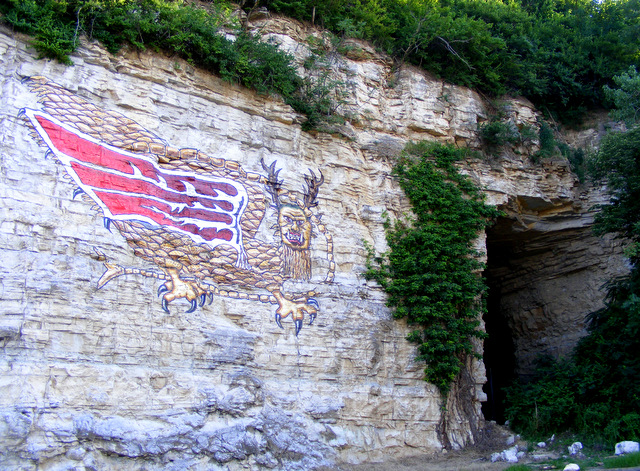
Things started out fine. We left the hotel at 7:04 and headed north. Just outside Alton, we happened upon the famous Piasa (Pie-a-saw) Bird painted on the riverside cliffs.

In 1673, when Marquette and Joliet explored the Mississippi, they described two “water monsters” painted on the cliffs somewhere in this vicinity. Twenty-five years later, the paintings had disappeared. Fast forward 140 years — a writer named John Russell embellished the legend in a novel, describing carvings in the rock of a dragon with wings. Russell is the one who came up with the name Piasa, which he said meant “the bird that devours men.” That story, and some obscure legends, inspired the city of Alton to paint this creature along the river.

The cliffs by the painting have some interesting caves, but, of course, this being Illinois, they were fenced off (something about falling rocks).

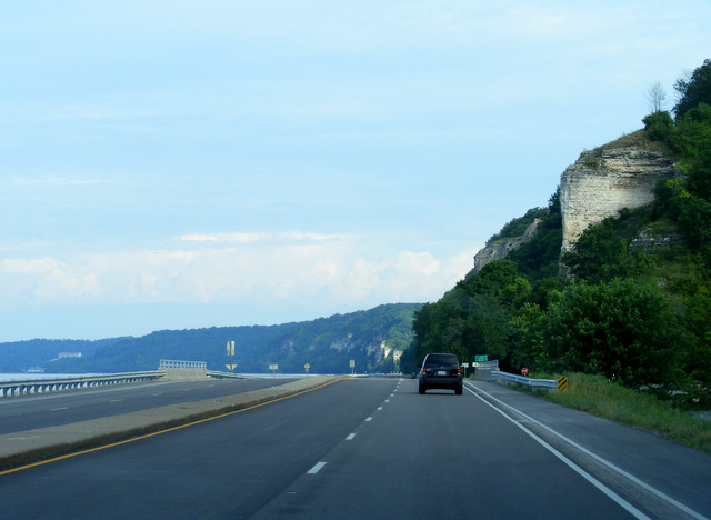
Route 100 along the river was stunning, especially for Illinois. The road ran right next to the water.

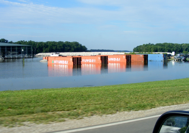
We could tell the water was high — here’s a house on one of the islands — but we thought nothing of it.

The road was sandwiched between the river and the cliffs.

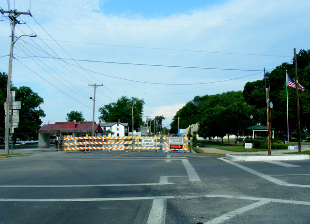
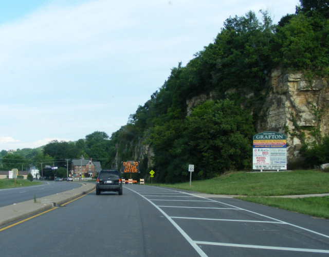
We arrived in Grafton, just a few miles from the Brussels Ferry, by 8:00 a.m. But that’s when things began to unravel. As we drove into town, we saw a sign that read, “Detour ahead due to high water.”

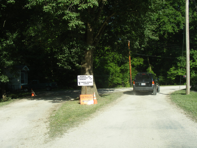
We soon came to the detour and were turned off onto an alley through the backside of the town.

It wasn’t long before we were back on Route 100, but we could see flooding all around.

We soon came to another detour.

This one routed us along even smaller, rougher roads. At one point, the city had dumped gravel on grass so we could drive through someone’s yard. Residents had stuck “Go slow” signs in the middle of the track so we had to drive on their grass to get around them. Finally, we were back on Route 100. But not for long.

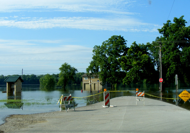
There were no more detours. This was as far as we were going along this road. I turned around and drove back along the detours. Now, a smart person would have stopped and asked if there was any point in going on. But I’ve always operated on the principle that “If you don’t want the answer, don’t ask the question.” We found a road away from the river and took off to get around the flooding to the ferry, which was about two miles ahead of where we’d been stopped. Our new route took us about 40 miles out of our way. We finally got to Route 100 near the town of Hardin and headed back south.

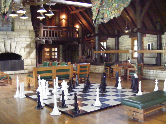
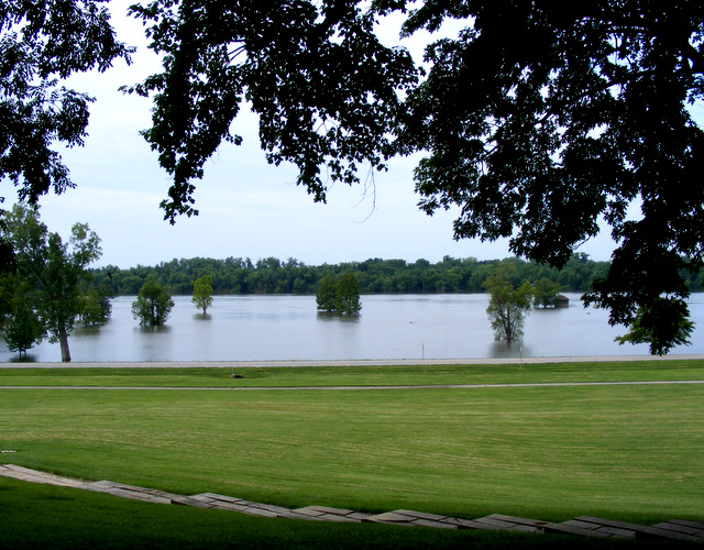
It wasn’t destined to happen. We made it as far as Pere Marquette State Park. We were along the Illinois River now, and it was just as flooded as the Mississippi. Water was across half the road as we pulled into the lodge. I asked a girl at the counter about the ferries, and she said they were all closed. It had never occurred to me that we would be unable to take a boat because there was too much water. Our plans were officially squashed. The lodge was impressive, and we’d like to get back there sometime. One of the features of the lobby was a giant chess set.

Here’s the river in front of the lodge.

Time was now becoming part of the issue. We had spent half the morning getting to this place. We were about 20 miles from where we were to meet the family, but we were on the wrong side of two flooded rivers. The nearest bridge to the north was much too far to be of any use. There was only one thing for us to do — retrace our path all the way back to Alton and cross at the bridge where we’d been early that morning.

Not only did we have to retrace our path, something I hate doing, but even once we got across the Mississippi, we were still about forty miles from our destination. Our 30 mile pleasant drive had turned into about 120 miles of frustration.

Posted in Illinois | Comments Off on Gang aft agley