
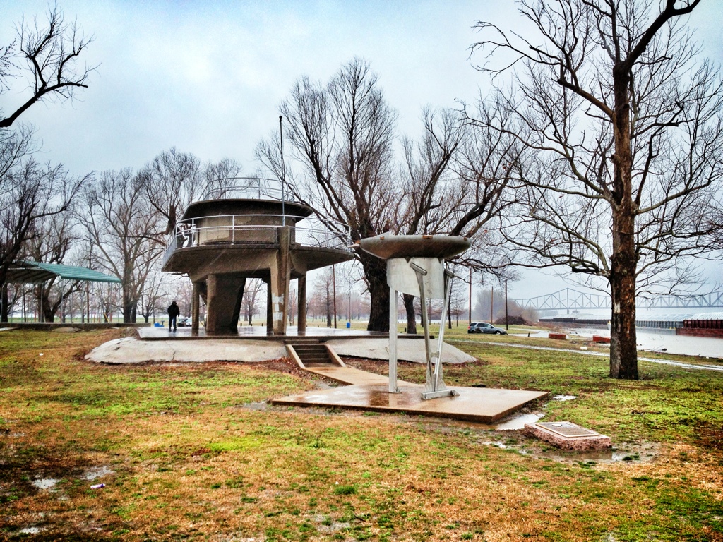
Fort Defiance Park used to be an Illinois State Park, but Illinois didn’t want it and allowed it to become a dump. To anyone familiar with Illinois, this shouldn’t be a surprise. The same thing is happening to much of the state. The small town of Cairo now owns the park, and the residents maintain it as well as can be expected for a site that gets flooded frequently. The park is at the extreme southern tip of Illinois, sandwiched between the Ohio and Mississippi Rivers — the two rivers join at the tip of the park.
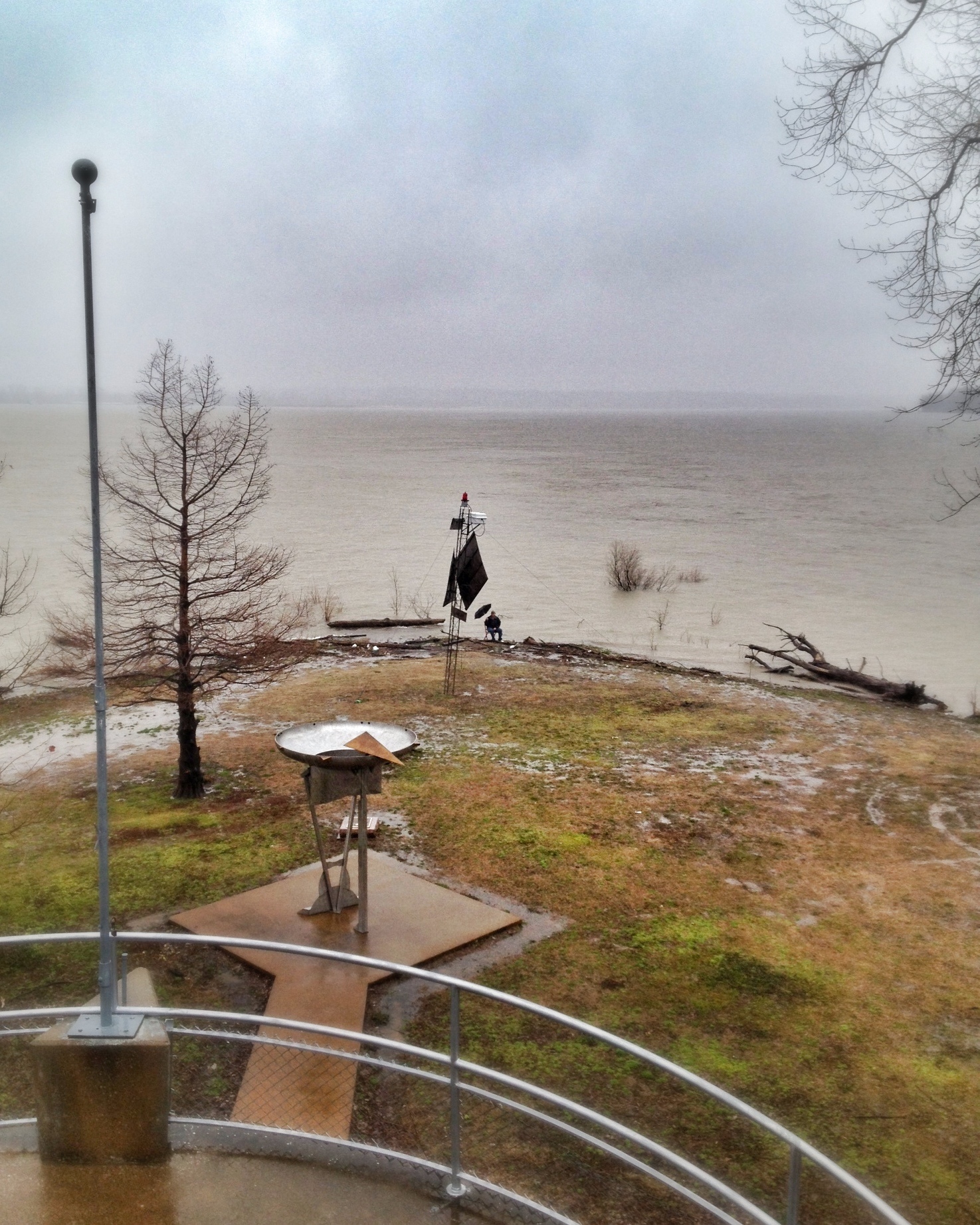
When we stopped by for a brief visit, it was raining steadily and the wind was blowing strongly. The rivers were high and it looked like another couple inches would flood the loop road out to the point. The women got out for quick looks and headed back to the warmth of the cars. My friend climbed the tower, an odd-shaped structure perhaps 50 yards from the confluence and took photos as I walked out to the very end of the state with the chair.
Surrounded by that much water that was so close to covering the land, with that wind and that rain, made me a bit anxious. I could barely see the shore of Kentucky on the left and Missouri on the right across the way. It felt a little bit dangerous. This was no weather for good cameras, so my friend shot a couple photos with his iPhone.

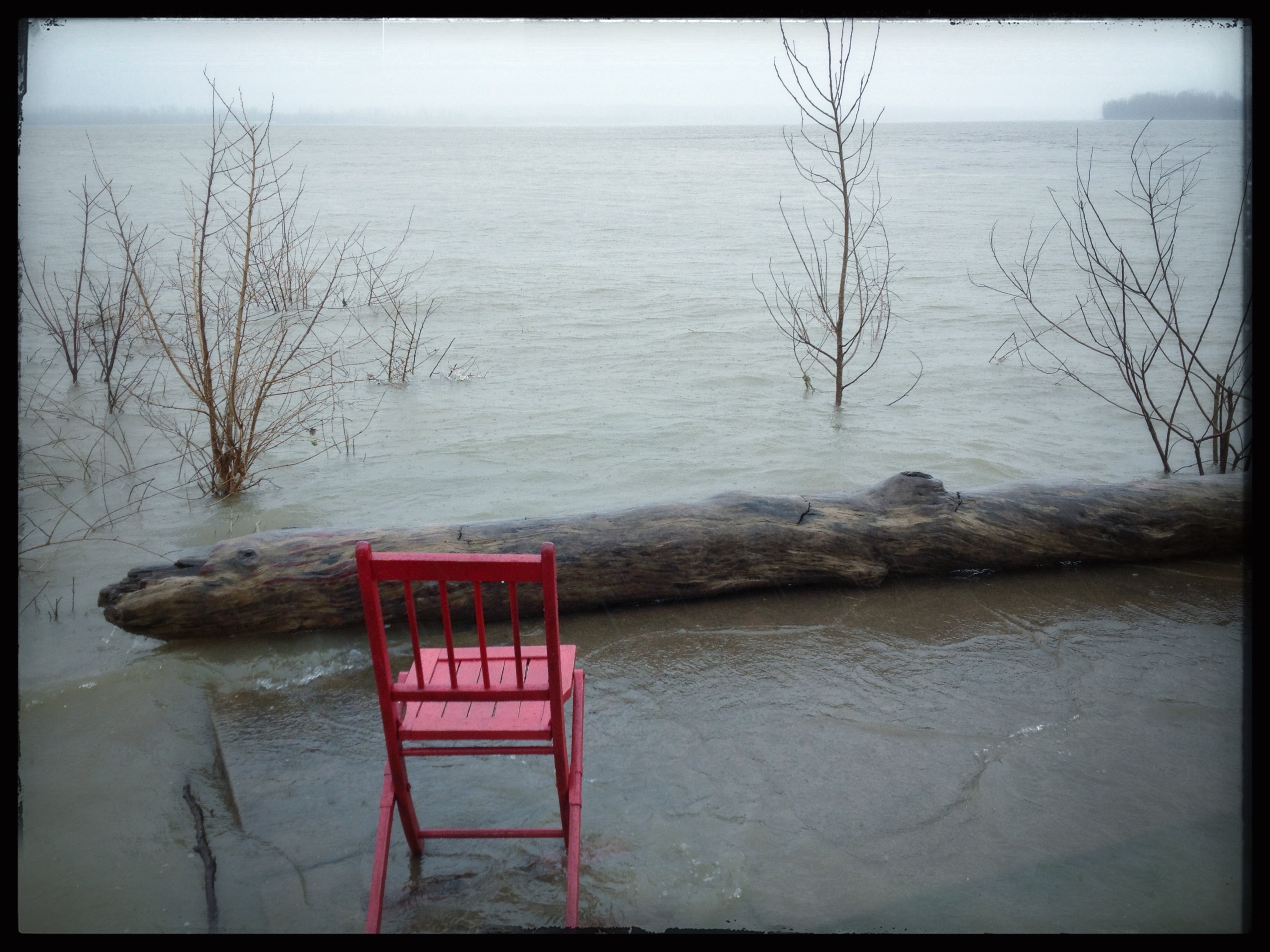
There was a flat area with engraved bricks just under the water by the log you can see in the above photos. I stuck the chair out there, with, as near as I could estimate, one leg in each river (there was no way to know for sure) and took this photo.
I would have liked to stay longer, but it was just miserable and we were getting hungry.