Adventures in Kansas

We set off from Colorado Springs on a Tuesday after work, headed for our annual Spring break camping trip in Arkansas. We made it through the flats of eastern Colorado with no more adventure than spilling a large glob of Taco Bell cheese on my shirt as we drove.

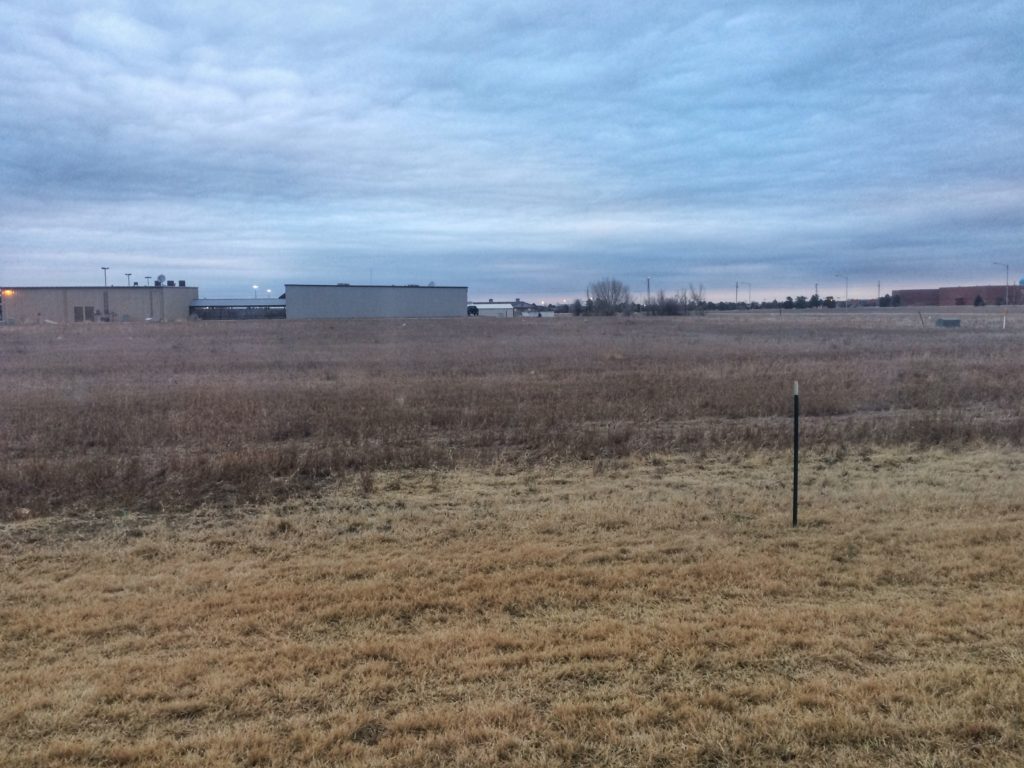
It was dusk as we entered Kansas and almost dark when we stopped in Colby for the night. The Hampton Inn was filled — I hadn’t made reservations because who goes to western Kansas on a Tuesday night in March — so we ended up at a worn-out, overpriced Holiday Inn Express. When I got up on Wednesday morning and looked out our window, this was the view. Something tells me we’re in Kansas anymore.

IMG_6544

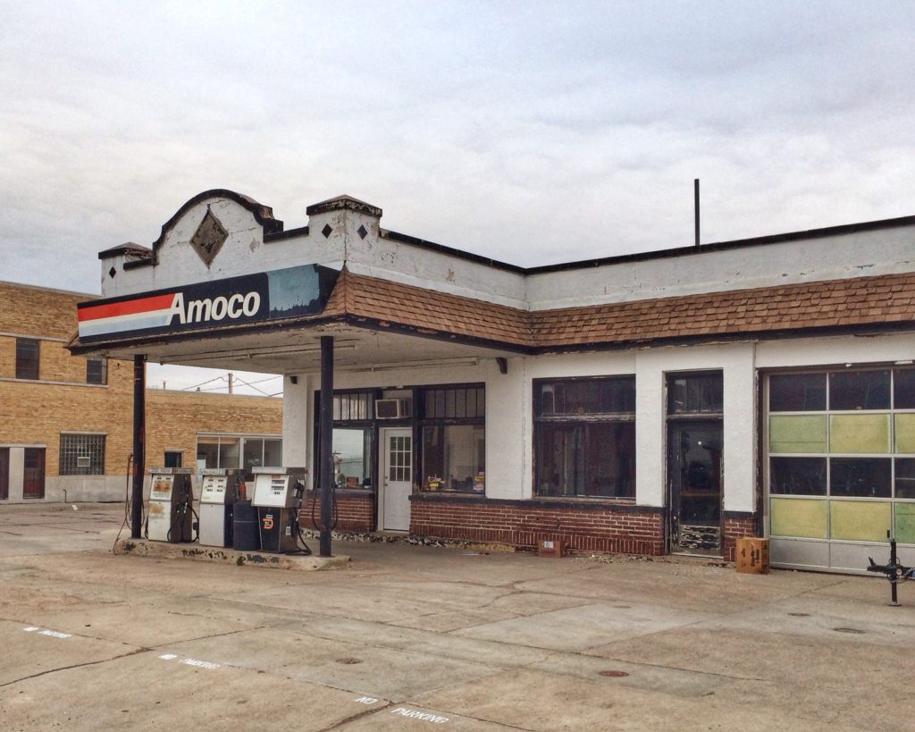
After grabbing some fruit and hard-boiled eggs at the breakfast bar, we drove about 20 miles to Oakley for donuts. Oakley appears to have been untouched since 1963, but Hey! The Annie Oakley Motel has color TV!

IMG_6543

IMG_6542

The Sunshine Bakery got good reviews for donuts. The two earnest young men inside were very nice. The donuts were average. They gave them to us in a Daylight Donuts bag, probably bought cheap from the boarded-up Daylight Donuts two doors down.

IMG_6541

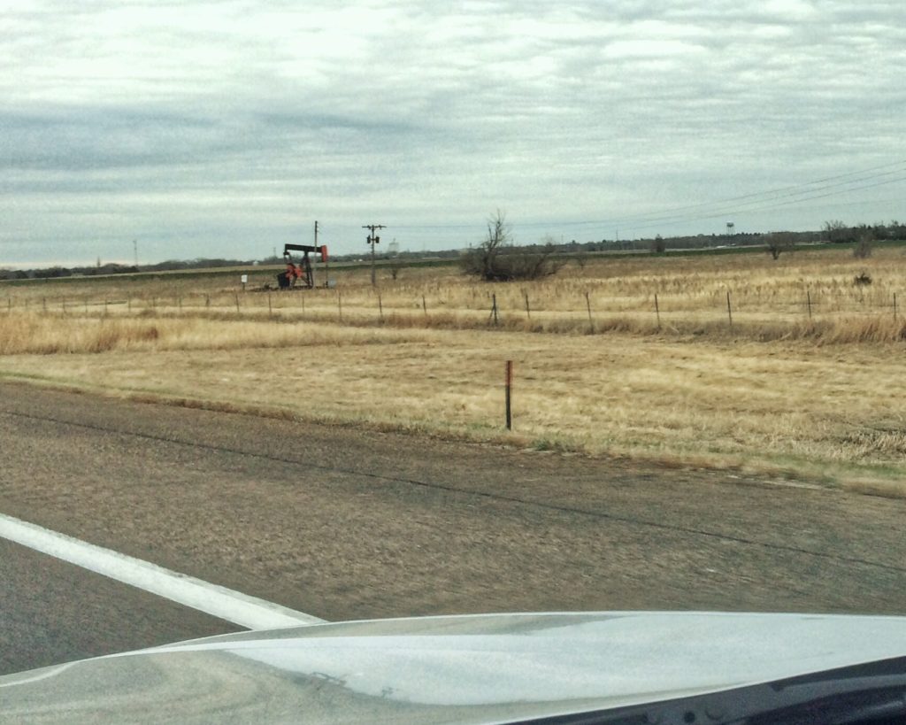
Back on the Interstate headed east. The scenery really started picking up.

IMG_6540

Oil wells were everywhere, especially as we got further east. They were the tallest things in view much of the time.

IMG_6539

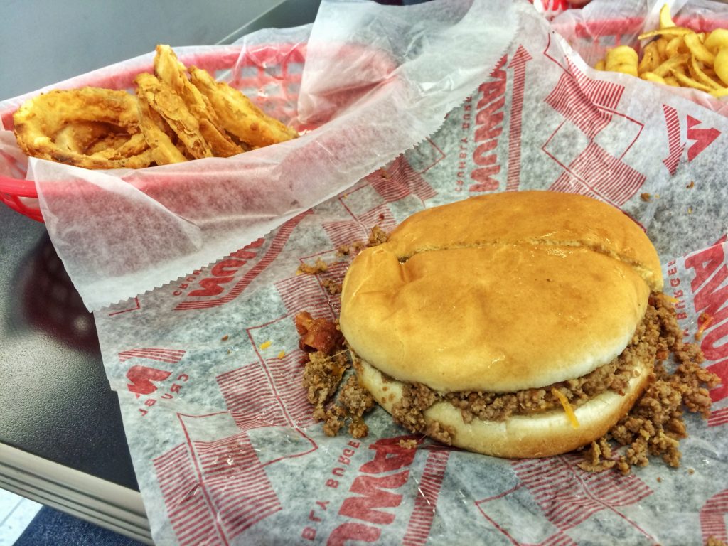
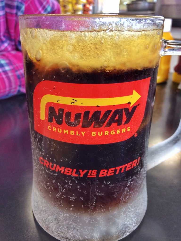
We stopped in Wichita for a late lunch at NuWay Crumbly Burgers.

IMG_6537

These were basically Iowa-style loose meat sandwiches. Think Sloppy Joes without the sauce. They give you a fork to eat all the bits that fall out of the bun. My bacon cheeseburger was a little bland, but the root beer and onion rings were excellent.

IMG_6535

IMG_6536

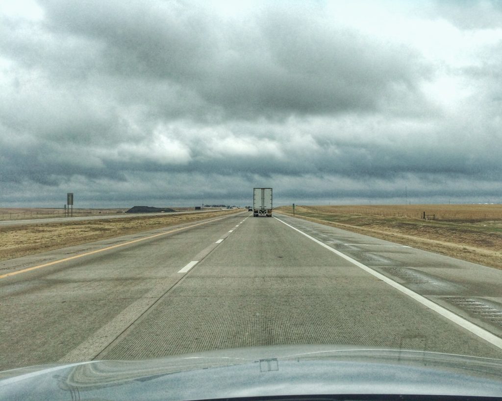
Back on the road for 200 miles of two-lane highway to Joplin, Missouri. There were a lot of trucks, which made for a lot of passing, which occasionally got interesting. I’m thankful for my six cylinders.

We passed through the famous Flint Hills.

IMG_6534

Kansas is a large state. The scenery give you the feeling that you’re going nowhere fast, which makes it seem even larger. We had to cross it again on the way home. We left Arkansas on Tuesday, March 28. This time we skipped the two-lane and drove I-40 west through Oklahoma to Oklahoma City, then cut north to Wichita. We stayed at a Hampton Inn in the suburb of Durby.

This was the view out our window this time.

IMG_6531

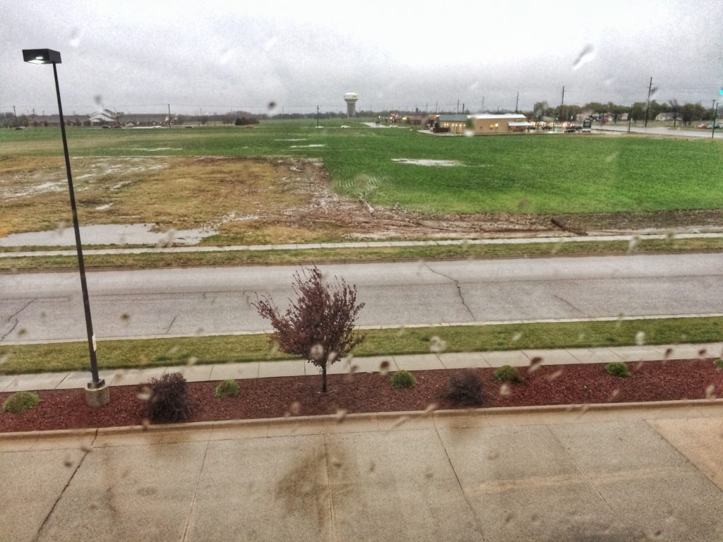
Yes, it was raining. And it kept raining all day until we got within six miles of the Colorado border.

After getting what healthy food we could find at the breakfast bar in the motel, we went to Derby Donuts. Their donuts were small (which is good) and tasty, the perfect size and taste to start the day.

IMG_6530

Driving was hazardous because the trucks were sending up so much spray it was impossible to see as I was passing them. I did manage to snap a photo of the world’s largest chimney sweep in McPherson as we drove by.

IMG_6529

We turned west at Salina, onto I-70, and then got off to drive 18 miles north to Lucas.

I’ll cover the exciting attractions of this town in other posts. I’ll just tease you here with this: the World’s Largest Souvenir Plate.

IMG_6528

After lunch at Sonic in Russell, we got back on the highway and back to the scenery.

IMG_6526

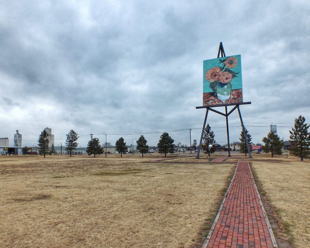
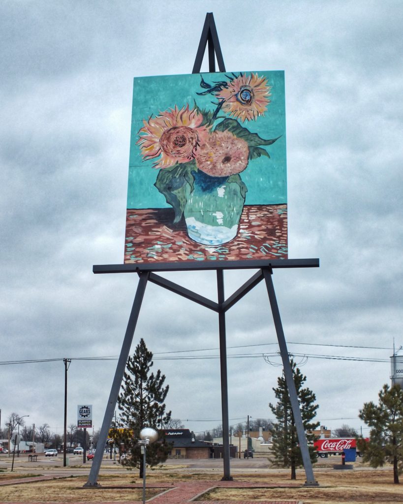
We made one last stop, in Goodland, to see the World’s Largest Easel, displaying Van Gogh’s Sunflowers.

IMG_6532

IMG_6533

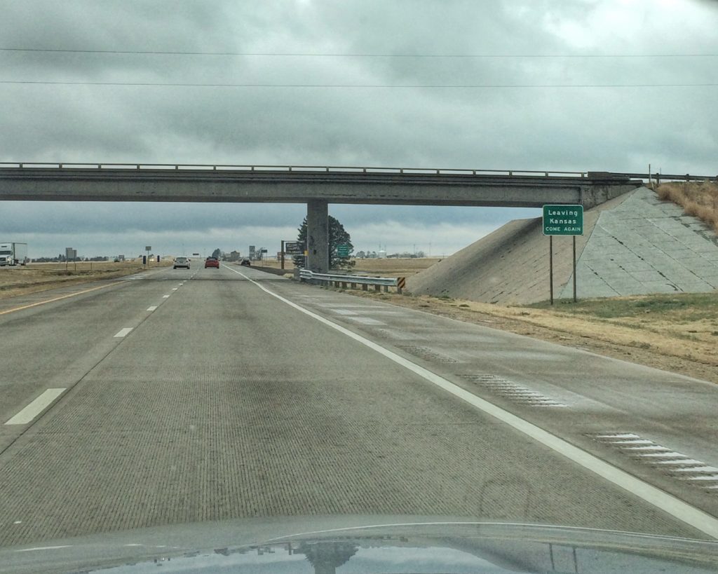
Finally, against all odds, the state came to an end. Boredom is subjective, but for scenic interest, Kansas holds it’s own against Illinois and Indiana.

IMG_6524

Posted in Road Trips | Comments Off on Adventures in Kansas

Ludlow Massacre Memorial

In 1913, coal miners from southern Colorado went on strike. They formed a large tent colony near the town of Ludlow where they stayed with their wives and children. In early 1914, the Colorado National Guard and units made up of guards from local mines surrounded the camp. On April 20, fighting broke out when someone fired a shot. By the end of the day, the camp was in flames and more than 20 people were dead, including two women and 11 children who had suffocated in a hole beneath a tent. Most of the miners and their families escaped when a freight train stopped next to the camp during the day and allowed them to climb aboard.

In retaliation, the miners attacked mines all over the area, burning buildings and attacking guards. The fighting lasted 10 days and another 50+ people were killed. The violence ended when Woodrow Wilson sent in Federal troops. John D. Rockefeller, Jr., who owned the mines, initiated reforms that improved the miners’ lives.

Ludlow no longer exists. The UMWA (United Mine Workers of America) purchased the site of the camp and erected a memorial. We stopped by on our way home from hiking in New Mexico. There’s a marble monument, a picnic shelter and some signs that give the story of the fight.

IMG_6444

IMG_6445

IMG_6447

IMG_6446

Posted in Battlefields | Comments Off on Ludlow Massacre Memorial

Bird #475 — Lewis’s Woodpecker

melanerpes (from melanos, black and herpes, a creeper) lewis (named after Meriwether Lewis by ornithologist Alexander Wilson)

Saturday, March 18, 2017

Lake Dorothey State Wildlife Area, Colorado

I saw on the Internet that 19 Lewis’s Woodpeckers were seen at Lake Dorothey on March 11. The wildlife area is on the New Mexico border, two-and-a-half hours from Colorado Springs. There are closer places where I could happen upon a Lewis’s Woodpecker. But I decided to turn the day into an adventure.

The parking area is just north of the state border. The trail leads up below the dam, with woods on one side and a clearing along Schwachheim Creek on the other. There was a forest fire there in the not-too-distant past, and dead, blackened Ponderosa Pine trunks covered the hills.

IMG_6437

We hadn’t gone far before we saw a Lewis’s Woodpecker fluttering over the clearing in the odd way they have. It landed in the trees on our right. A second one went over a few minutes later, close enough for my wife to see it’s red belly without binoculars.

Next to the dam, three more were flitting through the trees, chasing each other and rarely landing for more than a few seconds at a time.

We walked up onto the dam and then took the trail that led around the lake. We soon saw two more, and we got closer to these than to any others we saw.

IMG_6433

IMG_6405

I’ve read that they fly-catch from perches. I didn’t see any flies, but the woodpeckers frequently launched out in an odd, fluttering flight unlike the usual direct flight of other woodpeckers.

IMG_6404

IMG_6403

IMG_6402

IMG_6416

In all, I believe we saw nine at Lake Dorothey. When we crossed back into Sugarite Canyon State Park in New Mexico, I spotted three more. They were sticking close together and moving constantly, like the three I saw by the dam.

IMG_6417

As you can see by the photos, it was a stunning day, with temperatures near 80°. There was a cool breeze that made it a almost chilly in the rare shade. The area was beautiful too. It would have been nicer if the trees weren’t burnt, but then the woodpeckers wouldn’t have been there either.

Posted in Birds | Comments Off on Bird #475 — Lewis’s Woodpecker

Lake Dorothey State Wildlife Area

To get to this place, you have to head south into New Mexico, then return north through Sugarite Canyon State Park. We went here to see Lewis’s Woodpeckers (next post), but we enjoyed the view too.

The trail led up along Schwachheim Creek to the dam that forms Lake Dorothey.

IMG_6387

We were a little surprised to find some free-range cattle along the trail.

IMG_6389

Lake Maloya, in New Mexico, was just a couple hundred yards away.

IMG_6391

We hiked along the shore to the far end of Lake Dorothey.

IMG_6388

Beside the woodpeckers, we saw this American Kestrel.

IMG_6401

We also saw:

  • Song Sparrow
  • Great Blue Heron
  • Bufflehead
  • Canada Goose
  • Sandhill Crane (three large flocks high overhead)
  • Say’s Phoebe
  • Steller’s Jay
  • Common Raven
  • Western Bluebird
Posted in Birds, Scenery | Comments Off on Lake Dorothey State Wildlife Area

Sugarite Canyon State Park

We drove the two-and-a-half hours to this park because I’d seen that Lewis’s Woodpeckers were being seen nearby.

Coal was mined in the canyon from 1894 until the start of World War II. In 1912, a company town was built in the valley, and, at it’s peak, 1,000 people lived there. When the mines were shut down in the 1940’s, almost all the buildings were disassembled. The only remaining house now holds the visitor center. I asked the woman in the visitor center where the name “Sugarite” (pronounced SugarEAT) came from. She said the quick answer is that nobody knows, although some think it’s a corruption of an Indian or Spanish word.

We hiked part of the trail through the old town site and saw the foundations of many other buildings.

IMG_6449

We drove into Colorado to look for the woodpecker, then headed back over the border. About 150 yards from the state line, we found a picnic table in a shelter along Lake Maloya and enjoyed a leisurely lunch while watching a Bald Eagle in a tree across the water.

IMG_6448

IMG_6415

We drove to the dam, parked, and walked along the shore of the lake for a mile or so.

IMG_6432

IMG_6414

IMG_6412

Along the way, I spotted another Bald Eagle.

IMG_6418

It was a stunning day. The park would have been prettier if a forest fire hadn’t burned through some years back. But if it hadn’t, the woodpeckers wouldn’t be there and neither would we.

Our bird list for the park:

  • American Kestrel
  • Woodhouse’s Scrub-Jay
  • Dark-eyed Junco
  • White-breasted Nuthatch
  • Lincoln’s Sparrow
  • Spotted Towhee
  • Say’s Phoebe
  • Northern Flicker
  • Townsend’s Solitaire
  • American Robin
  • Common Merganser
  • Canada Goose
  • Redhead
  • Ring-necked Duck
  • Scaup (probably Lesser)
  • Bald Eagle
  • Mallard
  • Green-winged Teal
  • American Crow
  • Lewis’s Woodpecker
Posted in Birds, Scenery | Comments Off on Sugarite Canyon State Park